
Garmin eTrex 22x
4.3Editor score
Sunlight-readable color display
Topo Active routable maps
GPS and GLONASS support
A dependable handheld GPS for geocaching needs to do more than place a dot on a map. It should maintain a useful position beneath dense tree cover, guide you through unfamiliar terrain, display cache information clearly, and remain ready for long days outdoors. Screen size, battery life, navigation features, and physical controls all shape the experience.
This guide compares ten handheld navigators across the factors that matter most in the field. We considered display readability, supported satellite systems, mapping resources, geocaching functions, compass and altimeter features, ruggedness, storage, connectivity, and expected battery life. The list includes color and monochrome models, touch and button-operated designs, and units aimed at different navigation needs.
The selections show which options stand out for general geocaching, value-oriented outings, premium navigation, and specialized field use. Rankings reflect the supplied product specifications and customer ratings rather than personal testing. Specifications and availability can change, so readers should confirm the latest maps, accessories, connectivity requirements, and operating details before purchasing.
4.3Editor score

4.2Editor score

4.0Editor score
As an Amazon Associate we earn from qualifying purchases.
The comparison below places all ten navigators side by side, highlighting the differences in display, mapping, satellite reception, navigation sensors, connectivity, and battery configuration that matter most during geocaching outings.





The Garmin eTrex 22x is a straightforward handheld GPS that brings a readable color display, familiar Topo Active mapping, and multi-constellation positioning to a compact field unit. Its 4.3 customer rating places it among the strongest performers in this group. It is particularly well suited to geocachers who want a dependable navigator without the extra sensors found on higher-end models.
We may earn a commission when you buy through this link, at no additional cost to you.
Its 2.2-inch sunlight-readable screen offers 240 by 320 pixels, enough detail for navigating trails, reading terrain information, and locating cache icons. Preloaded Topo Active maps include routable roads and trails for hiking and cycling. GPS and GLONASS support improve tracking in challenging environments, while 8 GB of internal memory and a microSD slot provide room for downloaded maps.
The principal limitation is the absence of an electronic compass. Without one, the unit cannot provide a heading while stationary, so direction generally depends on movement. The 8 GB storage capacity is also modest compared with newer devices, although the card slot reduces the impact. These are sensible compromises for buyers who value simplicity, compactness, and readily replaceable batteries.
Choose the eTrex 22x if you need a capable color navigator for ordinary hikes, local cache hunts, and travel through unfamiliar areas. It is a particularly balanced recommendation for first-time buyers because it combines useful mapping, solid positioning support, and predictable battery operation. For advanced orientation or a stationary compass, the eTrex 32x is the more complete sibling.
Preloaded Topo Active maps keep navigation available beyond cellular coverage, while routable trails and roads help with broader route planning. The microSD slot also gives buyers room to add regional mapping when more detail is needed.
Support for both GPS and GLONASS can be helpful around thick woodland, deep canyons, and other places where a single satellite system may lose a clear view of the sky. Multi-GNSS does not eliminate every positioning error, but it adds useful resilience.
We may earn a commission when you buy through this link, at no additional cost to you.
The Garmin eTrex SE stands out because it directly addresses modern geocaching workflow rather than treating cache data as an afterthought. It has a 4.2 customer rating and combines a bright 2.2-inch display with automatic Geocaching Live updates, multi-GNSS positioning, a digital compass, and exceptional battery options. It is a strong all-around recommendation for active cache hunters.
We may earn a commission when you buy through this link, at no additional cost to you.
When paired with the Garmin Explore app on a compatible smartphone, the eTrex SE can receive software updates, trip planning, Active Weather, smart notifications, and additional mapping. Automatic Geocaching Live updates can include cache descriptions, logs, and hints. That connectivity reduces manual preparation and helps keep field information current, although the phone remains necessary for syncing.
The digital compass provides an accurate heading even while stationary, a meaningful advantage over simpler eTrex models. Multi-GNSS support covers GPS, GLONASS, Galileo, BeiDou, and QZSS, and the IPX7 water-resistant design handles rain and splashes. The main drawback is that batteries are not included, and some functions depend on compatible smartphone and app support.
Buy the eTrex SE if you regularly geocache and want current cache details without constant manual downloading. It is also attractive for hikers who value long battery life and broad satellite compatibility. The eTrex 32x may appeal more to buyers who prioritize expanded local map storage, while this model wins on automatic geocaching workflow and connectivity.
Automatic updates can bring descriptions, hints, logs, and other cache information to the navigator through Garmin Explore. For geocachers, that convenience can replace repeated manual downloads and make it easier to prepare for a trip immediately before leaving.
The eTrex SE can run for up to 168 hours in standard mode and up to 1,800 hours in expedition mode using two field-replaceable AA batteries. Users can adapt power consumption to the length and intensity of the trip.
We may earn a commission when you buy through this link, at no additional cost to you.
The Garmin GPSMAP 66s is the premium-oriented choice in this roundup, combining a large three-inch color display, multiple navigation systems, a three-axis compass, and a barometric altimeter. Its 4.0 rating reflects a capable but older feature set. The renewed designation may also matter to buyers who prefer a proven Garmin platform over a newer compact model.
We may earn a commission when you buy through this link, at no additional cost to you.
The sunlight-readable display is easier to interpret than the smaller screens on many eTrex units, which helps when reviewing terrain, route lines, or dense cache information. Preloaded TOPO maps cover the United States and Canada, while BirdsEye Satellite Imagery can be downloaded directly to the device without an annual subscription according to the supplied product information.
Wireless connectivity adds Active Weather forecasts, animated weather radar, and Geocaching Live syncing. Multiple GNSS support, the electronic compass, and the altimeter make this a more complete navigation platform than the eTrex 22x. The trade-off is bulk, the renewed condition, and a higher outlay for functions some hikers may not regularly use.
The GPSMAP 66s is best for geocachers and hikers who want a large screen, richer orientation tools, weather information, and satellite imagery. It is a sensible premium choice for extended trips, multi-day walks, and users who regularly consult detailed maps. Buyers who prioritize pocketability and the latest form factor may favor the smaller eTrex SE instead.
The three-inch display provides more room for cache lists, terrain detail, route review, and weather information. That additional space can reduce squinting and make the navigator more practical for users who are already comfortable reading a phone outdoors.
A three-axis compass supplies a heading even when the unit is stationary, while the barometric altimeter adds elevation information. Together, these sensors help with route direction and terrain awareness beyond the basic location circle.
We may earn a commission when you buy through this link, at no additional cost to you.
The Garmin eTrex 10 is a basic, durable approach to handheld geocaching. It carries a 4.3 customer rating, matching several more feature-rich products in the list despite its simpler design. Its worldwide basemap, paperless geocaching support, and straightforward physical layout make it a practical choice for users who need dependable positioning without a modern touchscreen.
We may earn a commission when you buy through this link, at no additional cost to you.
The WAAS-enabled receiver combines HotFix satellite prediction with GLONASS support for faster and more reliable positioning. A 2.2-inch monochrome display keeps information legible while reducing visual complexity. The device is waterproof to IPX7 standards and uses two AA batteries for up to 20 hours of operation, making it suitable for rain, mud, and long days on the trail.
Its limitations are the monochrome display and lack of a digital compass. Users who need richer terrain visualization, direct satellite imagery, or a stationary heading will need a more advanced unit. The older feature set also provides less detail for navigating complicated trails than the color models higher in the list.
Choose the eTrex 10 for straightforward geocaching, worldwide travel, or a backup unit that is easy to operate. Its paperless geocaching support is especially relevant to the category, while its physical controls work well with gloves. For most modern users, however, the eTrex 22x offers a more informative color display for a modest step up.
Built-in paperless geocaching lets the navigator serve as a practical offline cache-finding tool. It suits users who want basic cache functions without paying attention to a large collection of advanced navigation features.
The preloaded worldwide basemap provides broad geographic context wherever the unit is taken. More detailed regional mapping may still be desirable, but the included map helps orient users immediately.
We may earn a commission when you buy through this link, at no additional cost to you.
This generic handheld GPS offers a large 3.2-inch sunlight-readable screen, physical buttons, broad multi-GNSS support, and 32 GB of internal storage. Its 3.9 rating is slightly below the leading products, but the specification sheet suggests a capable hiking device. It may appeal to buyers who prioritize screen area, internal capacity, and modern USB-C charging.
We may earn a commission when you buy through this link, at no additional cost to you.
The display is combined with an anti-slip design and physical buttons that can be operated in varied conditions. GPS, Galileo, BeiDou, and QZSS support is listed, along with a claimed location precision within six feet. A three-axis compass and barometric altimeter add orientation and elevation functions, while trip and waypoint recording can help users retrace a route.
The rechargeable battery is rated for up to 36 hours in full charge and uses a standard USB-C cable. That removes the need to carry spare AA batteries on many trips. The IP66 water-resistance rating and preloaded USA topographic maps make it appealing for US hiking and camping, though users traveling elsewhere may need additional maps.
This is a worthwhile option for someone who wants a large screen, generous storage, and a rechargeable power system in a physical-button design. Its main drawback is less obvious geocaching integration than the Garmin eTrex SE or Montana 680, both of which explicitly mention Garmin ecosystem and cache services. Verify compatibility with the geocaching workflow you use before committing.
Thirty-two gigabytes of internal memory is among the most generous storage figures in this comparison. That room can support downloaded topographic maps and other navigation assets without relying immediately on a removable card.
Physical buttons remain easy to use when wet, cold, or gloved, while the anti-slip housing supports steadier handling. The large screen helps offset the fact that some information may take more space to read than on a compact unit.
We may earn a commission when you buy through this link, at no additional cost to you.
The Garmin eTrex 32x is a well-rounded button-operated navigator that adds a three-axis compass and barometric altimeter to the core strengths of the eTrex 22x. Its 4.2 customer rating reflects a balanced combination of rugged construction, color mapping, and useful sensors. It is a compelling choice for hikers and geocachers who want more orientation capability without a touchscreen.
We may earn a commission when you buy through this link, at no additional cost to you.
The 2.2-inch sunlight-readable color display uses 240 by 320 pixels, and preloaded Topo Active maps include routable roads and trails. GPS and GLONASS support assists tracking in difficult terrain. Internal storage totals 8 GB, with a microSD card slot allowing further map downloads when a specific region requires more detail.
The biggest improvement over the eTrex 22x is the three-axis compass, which can provide a heading even when standing still. The barometric altimeter adds useful elevation information. On the other hand, the device lacks the eTrex SE's automatic Geocaching Live updates, and the 8 GB internal capacity is modest for extensive regional map libraries.
Buy the eTrex 32x when you want a capable standalone navigator with physical controls, color maps, and a stationary compass. It is a particularly good fit for cold-weather hikes, backpacking, and anyone who finds touchscreens awkward with gloves. The eTrex 22x remains the simpler value choice, while the eTrex SE serves connected geocaching workflows.
The three-axis compass provides directional information without requiring the user to start walking. This makes the eTrex 32x easier to use for identifying a cache direction, checking a route, or comparing a map while standing at an intersection.
Physical buttons are dependable when fingers are cold, wet, or covered by gloves. The straightforward interface also reduces accidental input compared with a touchscreen, a meaningful benefit during fast-moving outdoor navigation.
We may earn a commission when you buy through this link, at no additional cost to you.
The Garmin Oregon 550T is built for geocachers who want to document finds and surrounding scenery, not merely navigate to coordinates. Its 4.3 rating, three-inch sunlight-readable color touchscreen, and 3.2-megapixel autofocus camera distinguish it from navigation-only alternatives. It combines traditional hiking tools with a convenient built-in camera.
We may earn a commission when you buy through this link, at no additional cost to you.
The camera includes 4x digital zoom and can save a visual record of a cache, trail, puzzle solution, or landmark. A built-in three-axis tilt-compensated electronic compass maintains a useful heading without requiring the user to hold the device level. The barometric altimeter tracks pressure changes to help pinpoint altitude and can plot pressure over time.
Durability is another strength because the Oregon 550T is described as rugged and waterproof, with a bright touchscreen suited to viewing maps and cache details. The trade-off is age: a 3.2-megapixel camera and older device platform may not satisfy buyers who want modern photo quality or the most current mobile ecosystem. Gloves can also make its touchscreen less convenient than a button-operated unit.
Choose the Oregon 550T if photographing caches and documenting the trip are important parts of your workflow. It is also a good fit for hikers who prefer a large screen and touch navigation. For more modern geocaching syncing, the Montana 680 is the stronger comparison, while the eTrex 32x is the better choice for glove-friendly physical controls.
A built-in autofocus camera removes the need to carry a separate device for cache photos. The 3.2-megapixel sensor and 4x zoom are modest by current phone standards, but they remain practical for documenting a find, a puzzle clue, or the surrounding site.
The tilt-compensated electronic compass is designed to retain an accurate heading even when the device is not held perfectly level. That gives the Oregon 550T more flexibility than a simple pointer compass during active navigation.
We may earn a commission when you buy through this link, at no additional cost to you.
The Garmin Montana 680 is the most explicitly geocaching-focused model in the roundup. It ships with 250,000 preloaded worldwide geocaches from Geocaching.com and includes a one-year Birdseye Satellite Imagery subscription. Its 4.1 rating reflects a capable, feature-rich platform with a large touchscreen and a high-resolution camera.
We may earn a commission when you buy through this link, at no additional cost to you.
The preloaded cache collection gives users immediate access to a substantial worldwide database, while the high-sensitivity WAAS-enabled receiver, Hotfix prediction, and GLONASS support assist positioning in heavy cover and deep canyons. Track Manager organizes waypoints, routes, and track logs, and the eight-megapixel camera can geotag images automatically with coordinates.
The expansive screen is useful for reviewing cache details and navigating routes, although a touchscreen can be less convenient than physical buttons in wet or cold conditions. The stated imagery subscription is time-limited, so long-term access may require checking current terms and coverage. The device is also an established older platform rather than a newly introduced design.
Buy the Montana 680 when having a substantial onboard geocache database matters more than compact size. It is an excellent fit for travelers, multi-region cache hunters, and users who enjoy documenting locations with photographs. The Oregon 550T offers a smaller form and rugged touchscreen experience, but the Montana's cache collection and higher camera resolution provide distinct advantages.
Two hundred fifty thousand preloaded worldwide geocaches give the unit an immediate practical advantage for spontaneous trips. Users can explore a broad cache selection without completing a full manual download before every outing.
Track Manager supports waypoints, routes, and track logs, with straightforward controls for starting and stopping recordings. This makes the Montana 680 useful for both finding individual caches and reviewing a longer hike afterward.
We may earn a commission when you buy through this link, at no additional cost to you.
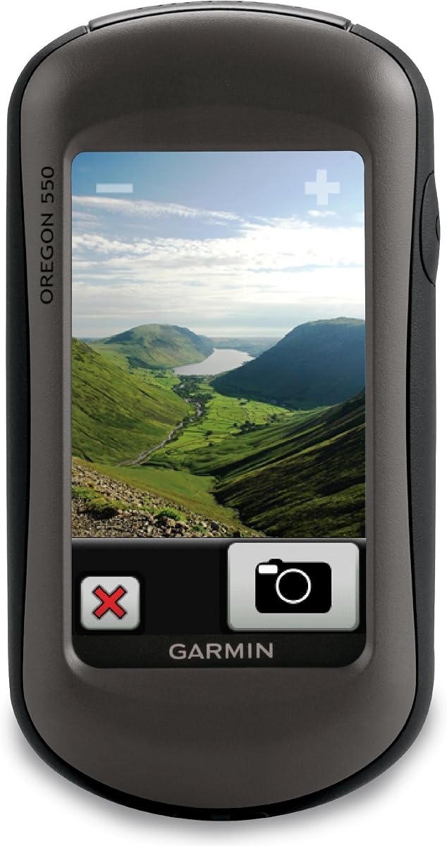
The Garmin Oregon 550 is a rugged general-purpose hiking GPS with a bright touchscreen, a built-in camera, and a worldwide basemap. Its 4.0 rating makes it a credible alternative to the closely related Oregon 550T. It is especially relevant for hikers who want more map and photo features than a basic eTrex provides.
We may earn a commission when you buy through this link, at no additional cost to you.
Its 3.2-megapixel autofocus camera includes 4x digital zoom for recording scenery, trail conditions, and cache locations. The three-inch sunlight-readable color touchscreen is suitable for viewing detailed maps. A built-in three-axis tilt-compensated electronic compass shows heading while stationary, and the barometric altimeter supports elevation tracking and awareness of changing pressure.
The preloaded worldwide basemap includes shaded relief, while a MapSource microSD card can add more detailed maps. The device is described as durable and waterproof, making it suitable for demanding outdoor conditions. Compared with the 550T, however, its product information does not highlight US topographic mapping, so buyers should check which regional map coverage is important to them.
Choose the Oregon 550 if you need a rugged touchscreen navigator with a camera, compass, altimeter, and expandable mapping. It is a strong hiking option and can still serve geocaching needs. For a more explicitly cache-focused model, the Montana 680 offers a larger preloaded geocache collection, while the 550T is the closer topographic-map alternative.
The worldwide shaded-relief basemap offers useful context from the outset, and the microSD expansion path allows for more detailed regional mapping. That flexibility helps hikers travel across areas where the default basemap may be insufficient.
The rugged, waterproof body is intended to withstand outdoor use, while the large color display makes map interpretation easier. It is a good fit for users who want a modern touchscreen without carrying a separate camera.
We may earn a commission when you buy through this link, at no additional cost to you.
The Garmin Oregon 200 is a basic portable GPS with a high-sensitivity receiver, a 2.6-inch color TFT display, and a built-in worldwide basemap. Its 3.2 customer rating is the lowest among the listed devices, so it should be considered an entry-level option. Even so, its dedicated geocache profile gives the category some direct relevance.
We may earn a commission when you buy through this link, at no additional cost to you.
The display provides 240 by 400 pixels and uses rugged touchscreen technology for map and menu interaction. A built-in worldwide basemap gives immediate geographic reference, while the high-sensitivity receiver is designed to acquire and hold a position for navigation. Five user profiles cover automotive, marine, recreation, fitness, and geocache activities.
This model's main weakness is its age and limited feature set relative to newer choices. It does not list the multi-GNSS support, advanced sensors, cache syncing, camera, internal map storage, or expandable memory found in the more capable products. For frequent modern geocaching, a newer model will usually provide a more satisfying workflow.
Choose the Oregon 200 for basic navigation, a compact secondary GPS, or a geocaching profile in a simple device. It may also suit buyers who specifically want a touchscreen without a premium feature set. For daily geocaching, however, the eTrex 22x or eTrex SE offers a more current platform, better stated satellite support, and more useful mapping options.
One of the five configurable profiles is specifically intended for geocaching. While limited compared with modern cache-sync features, it keeps the device aligned with the core activity represented by the category.
The compact color display and worldwide basemap make the Oregon 200 approachable for basic route finding. Multiple activity profiles also let the same unit adapt to different outdoor and travel activities.
We may earn a commission when you buy through this link, at no additional cost to you.
The best handheld GPS for geocaching is the one that combines dependable positioning, legible mapping, practical cache information, and enough endurance for the intended trip. Screen preferences, connectivity, sensors, and battery strategy should follow from how and where you hunt caches.
Prioritize multi-GNSS for frequent off-trail geocaching or remote travel. For straightforward local hikes, a simpler receiver may be sufficient.
Choose a larger screen for detailed map review and a compact physical-control design for quick, gloved operation in the field.
Verify local topographic coverage and download maps before a trip. Never rely on a basic basemap where precise trail data is required.
Frequent cache hunters should prioritize automatic syncing and downloadable descriptions; basic hikers can choose simpler paperless support.
Add a compass and altimeter when navigation involves ravines, ridges, or route-finding in poor visibility. They are valuable but not essential for every casual outing.
Match the power system to trip length. Carry spare batteries for remote routes or choose a rechargeable model when daily charging is practical.
Choose a camera-equipped unit for convenient geocache documentation. Carry a phone separately when high-quality photography or flexible framing matters most.
Prioritize water resistance and simple physical controls for rough trips. Choose a touchscreen for a more visual, map-centered workflow.
Before a trip, update the unit's software, compatible maps, and geocaching information. Read the controls in a safe setting, verify that the cache-management application is paired correctly, and download the region where you expect to travel. Open the route or area offline and confirm that the scale, north arrow, coordinate format, and map layers are easy to interpret. A short practice walk can reveal whether the display or button layout suits you.
On the trail, treat the handheld as a navigation aid rather than an unquestionable source of truth. Compare its position with the map, trail signs, terrain features, and the cache's stated hints. Keep the device accessible rather than buried in a pack, and use the compass or elevation data to cross-check your direction. Save useful waypoints, avoid repeatedly changing screens, and use battery-saving modes when your route no longer needs constant high-frequency tracking.
After the outing, dry the unit, remove any batteries if the manufacturer recommends it, and inspect the battery compartment and connectors for moisture or dirt. Keep contacts clean and avoid exposing the device to excessive heat or prolonged direct sunlight. Download your track and logs, confirm that saved finds are complete, and back up important waypoints. A protective case and a regular inspection routine will help preserve dependable operation over repeated seasons.
A touchscreen is convenient for browsing maps and cache details, but it is not required. Physical-button models such as the eTrex 22x and eTrex 32x can be easier to operate with cold or gloved hands. The best choice depends on whether you prioritize quick map interaction or dependable tactile controls in difficult weather.
GPS is one satellite navigation system, while multi-GNSS combines signals from systems such as GPS, GLONASS, Galileo, BeiDou, and QZSS. More systems can improve positioning consistency in canyons, forests, and other obstructed locations. The improvement varies by environment, but multi-GNSS generally offers greater resilience than a GPS-only receiver.
Yes. Handheld GPS units are designed to calculate positions using satellite signals, and most include or support downloadable maps for offline use. Geocaching features that require app syncing should be completed before leaving coverage, but the core navigation and any maps already stored on the device remain available in the field.
Storage needs depend on the regions and map detail you want to carry. The eTrex 22x and eTrex 32x provide 8 GB internally plus microSD expansion, while the Montana 680 and generic rugged GPS offer more built-in capacity. Download only the regions you plan to visit and leave room for updated files, tracks, and waypoints.
AA batteries are convenient for remote trips because they are easy to carry in quantity and can be swapped without a charger. Rechargeable systems reduce disposable battery waste and may be more practical for frequent local outings. Consider expedition mode, charging access, and the possibility of a dead unit before choosing the power style.
Not necessarily. A camera is useful for documenting a cache or recording clues, but display readability, positioning, map coverage, battery life, and cache-management features usually matter more to the core geocaching experience. Higher resolution is an added benefit for documentation rather than a substitute for reliable navigation.
They are highly useful when you need a stationary heading or detailed elevation information. The compass helps with direction without movement, while the altimeter supports route assessment and recognizes changes in elevation. For casual local walks, they are optional, but hikers in steep or complex terrain will receive more value from both sensors.
A renewed model may provide a mature feature set at a lower outlay, but its condition and remaining system support deserve careful review. A newer model may offer a more current form factor, charging system, or sensor configuration. Compare the actual navigation and geocaching features rather than relying on model age alone.
The Garmin eTrex 22x is the most balanced budget-oriented choice, combining a readable color screen, Topo Active maps, GPS and GLONASS, and a practical battery life. The Garmin eTrex SE is the strongest connected option because automatic Geocaching Live updates, broad multi-GNSS support, a digital compass, and long battery options support an efficient modern workflow.
The Garmin GPSMAP 66s is the premium selection in this group, with a larger display, a three-axis compass, a barometric altimeter, satellite imagery downloads, and wireless weather and cache connectivity. Whichever model you choose, prioritize the map coverage of your normal caching area, the ability to operate controls in expected weather, and satellite support appropriate to the terrain you explore.
Before buying, check the latest product specifications, regional map availability, battery configuration, and geocaching app compatibility. Retail listings and current selling terms can change over time, so verify the present details directly before making a final decision.